

alerte e avvisi
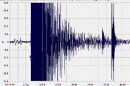
Ore 16,05 del 23 dicembre, scossa di terremoto in Emilia, 5,1 Richter
|
Summary
On 12/23/2008 3:24:23 PM UTC (about 16:05h local time) an earthquake of magnitude 5.3 occurred in the very highly populated region of Emilia-Romagna in Italy. The earthquake happened 19km from Bugojno. The nearest populated places are: Mokronoge (19km), Zvirnjaca (15km), Baljci (13km), Zahum (18km), Suica (12km), Donje Ravno (11km), Begovac (14km), Donji Malovan (9km), Gornje Vukovsko (11km), Rilic (2km), Dolnje Vukovsko (4km), Gornji Malovan (4km), Ivica (14km), Mracaj (8km), Kordici (16km), Begovo Selo (6km), Ost (19km), Zlosela (9km), Kupres (9km), Vesela (17km), Bajramovci (18km), Porice (16km), Rasticevo (15km). The closest civilian airport is Sinj (55km). Potentially affected critical infrastructure:
Whether international humanitarian aid is needed must be decided by an expert. However, the following automatically calculated elements can help. This earthquake has potentially a low humanitarian impact and the affected region has low vulnerability to natural disasters.
See the GDACS website for live news coverage (including OCHA Situation Reports), the full earthquake report . For information on emergency response, please consult the GDACS Virtual OSOCC. |
||||||||||||||||||
|
|||
 Population Density near epicenter (people/km2). Image area: 6x4 decimal degrees (approx. 650x450km2).
|
Potentially affected People
The population in the area of this earthquake is 182 people/km2. The earthquake occurred at 16h local time. At this time a day, more people are at work and therefore more vulnerable to collapsing office buildings. During traffic hours, people can be affected by collapsing bridges and other road infrastructure. |
||||||||||||||||||||||||||||||

Resilience and Vulnerability
Resilience is the capacity of the population to cope with a hazard. Since much of investments in earthquake preparedness and available funds for quick response is related to household income, the GDP per capita can be used as a rough indicator of resilience. Italy has a GDP per capita of 20174 PPP$ (Parity Purchasing Power Dollar, about 1 Euro) and is therefore part of the high level income countries. Therefore, the earthquake happened in an area of high resilience. Based on the combination of 9 indicators, ECHO attributes Italy a low vulnerability. |
||||||||||||||||||||||||||||||
|
Secondary effects
Probability of secondary effects:
|
||||||||||||||||||||||||||||||
 Landslides: The maximum slope in the area of the earthquake is 41.849% and the maximum altitude is 1973 m. Since this is a medium slope, the risk of earthquake induced landslides is medium. Note, however, that the slope data is not reliable on a local scale, while landslides depend very much on local topography, soil and meteorological conditions.
© Parte dei materiali in visione sono stati reperiti sul web | Responsabile Pio Acito disaster manager | powerd ideama 2025
Associazione di Volontariato Civile delibera Regione Basilicata n.1331/'94 |
Associazione di Volontariato di Protezione Civile - Presidenza Consiglio dei Ministri
Dipartimento P. C. prot. n. 85990 5.1.1.4/'95 | C.F. 93018590773
Le immagini si riferiscono prevalentemente alle attività dell'associazione. Coloro che si ritengono danneggiati possono richiedere la rimozione, che sarà effettuata prontamente
Le immagini si riferiscono prevalentemente alle attività dell'associazione. Coloro che si ritengono danneggiati possono richiedere la rimozione, che sarà effettuata prontamente